(TITC) - Trang An Landscape Complex covers an area of 6,172ha in districts of Hoa Lu, Gia
Vien, Nho Quan, Tam Diep Town and Ninh Binh City, about 90km to the southeast
of Ha Noi. The complex is surrounded by a buffer zone of 6,268ha, mostly comprising paddy rice fields and villages. As a mixed cultural and
natural property, Trang An Landscape Complex contains three protected areas,
including Hoa Lu Ancient Citadel Cultural � Historical Area; Trang An � Tam Coc
� Bich Dong Scenic Area and Hoa Lu Special-Use Primary Forest.
Located in the humid tropical region,
Trang An Landscape Complex is a mountainous area that extends
in a northwest-southeast direction. To the north and northwest of
Trang An lie Bai Dinh karst hills; to the southwest and the south are Dong Tam
� Son Ha and Tam Coc � Bich Dong karst ranges; to the southeast and northeast
is Truong Yen karst range; to the
northeast and the north is Trang An karst range. River
network in Trang An is well developed with Hoang Long River to the north, Chanh
River to the east, He River to the south, Ben Dang River to the west and river
systems of Sao Khe, Ngo Dong and Den Voi in the heart of the heritage. Trang An
Area was invaded and reworked by the sea many times in the recent geological
past but is now emergent on land. Landform development over a period of more than
five million years produced scenic landscape of extraordinary beauty � a blend
of towering cliff-bounded mountains draped
in natural rain
forest, surrounded by
huge and deeply
developed internal basins
whose clear and quietly flowing waters are connected
through a myriad of underground streams and caverns, many of which are
navigable by small sampans carrying tourists.
Outstanding values
Cultural value
Trang An is a prominent place in Southeast Asia and the world which contains
abundant archaeological evidences preserved almost intactly, mostly shells, animal bones, pottery, stone
tools, kitchen floor and human remains. This is an
extremely valuable documentary treasure demonstrating the way that prehistoric human
interacted with natural landscape and adapted to major changes of environment
over more than 30,000 years, at least since the late Ice Age. During this time, they endured some of the most turbulent climatic and geographical changes in the Earth's history.
Besides, cultural and historical relics such as pagodas, temples, palaces in
Trang An also contribute to consolidating many archaeological
documents.
Aesthetic value
The karst tower landscape of Trang An is among
the most beautiful and awe-inspiring places of its kind anywhere in the world.
Dominating the landscape is a spectacular array of cone-shaped rock towers
whose sheer vertical walls rise abruptly 200m above the surrounding land
and water. Narrow interconnecting ridges, which have
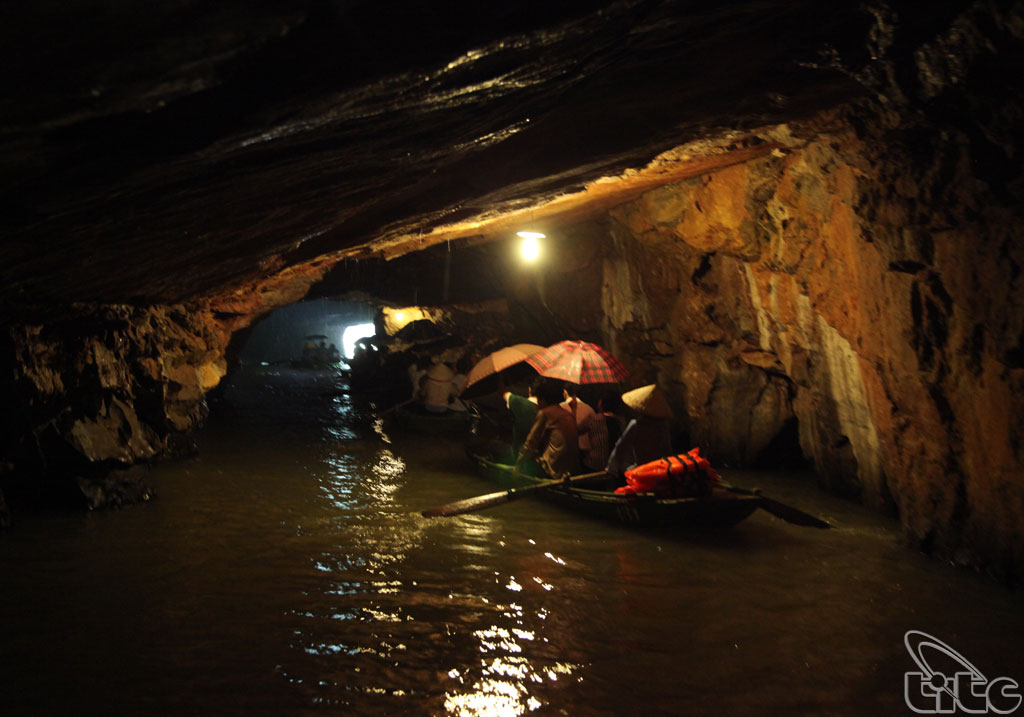
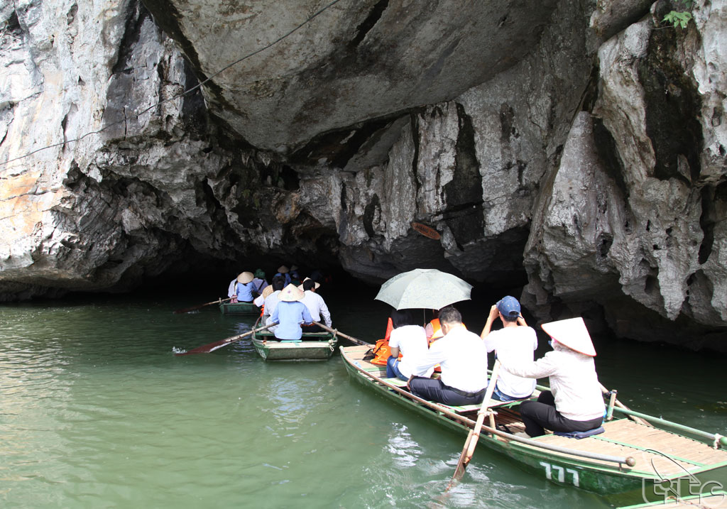
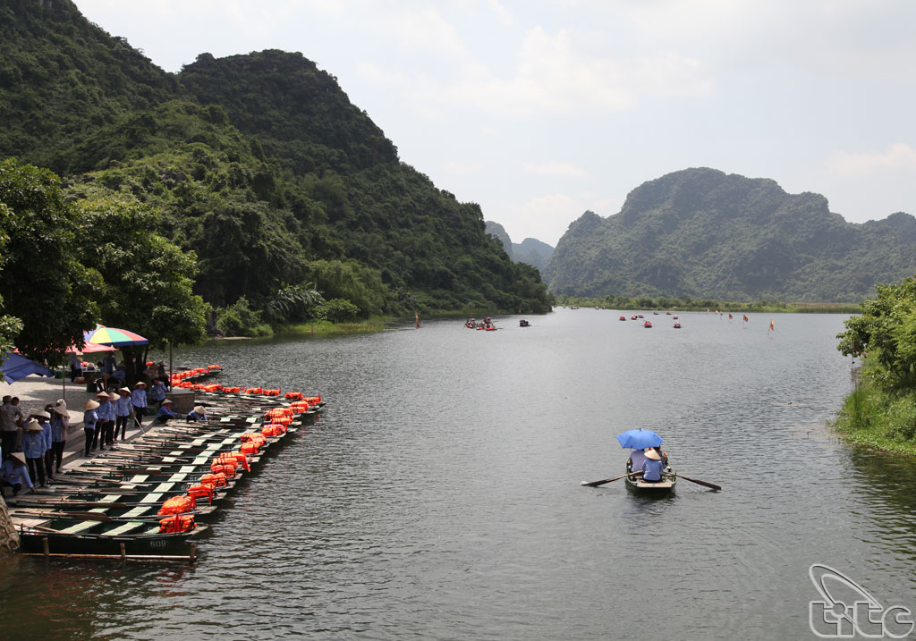
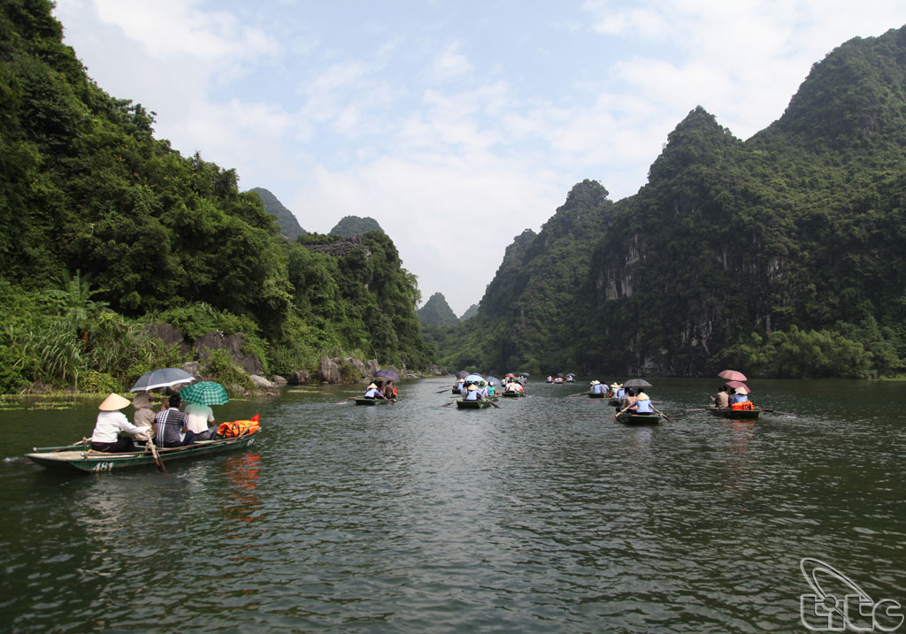
been likened to mythical giant swords, enclose circular and linear depressions
whose expansive waterways are linked by gently flowing streams winding through
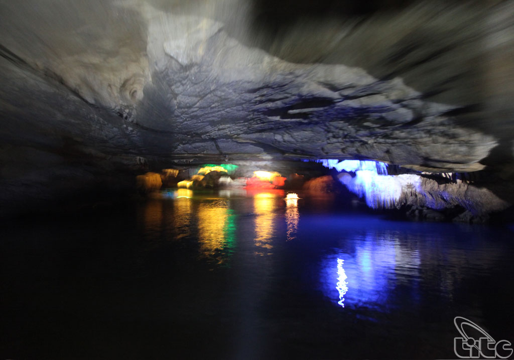
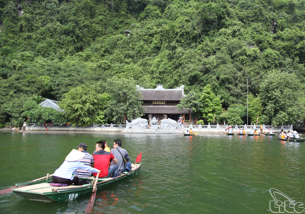
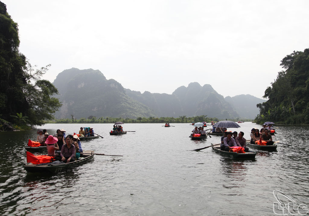
subterranean caverns up to one kilometer in length. Visitors, carried through
these passages in small traditional sampans, can enjoy the multitude of
fascinating carbonate stalactites, curtains and other decorations that adorn
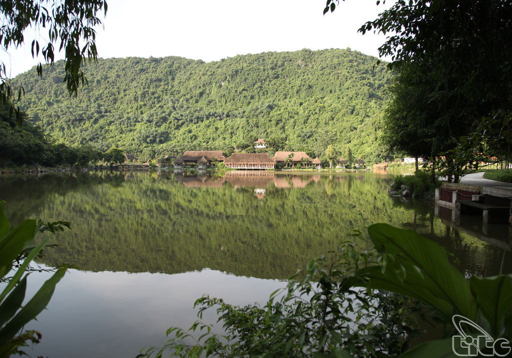
the ceilings. Dense rain forest covers the landscape, even clinging to the
cliffs and peaks. Blending naturally
and beautifully with the
forests are the
extensive rice paddy
fields bordering the
rivers, creating a
picturesque patchwork of color,
enlivened by the presence of local farmers and fisher folk engaged in their
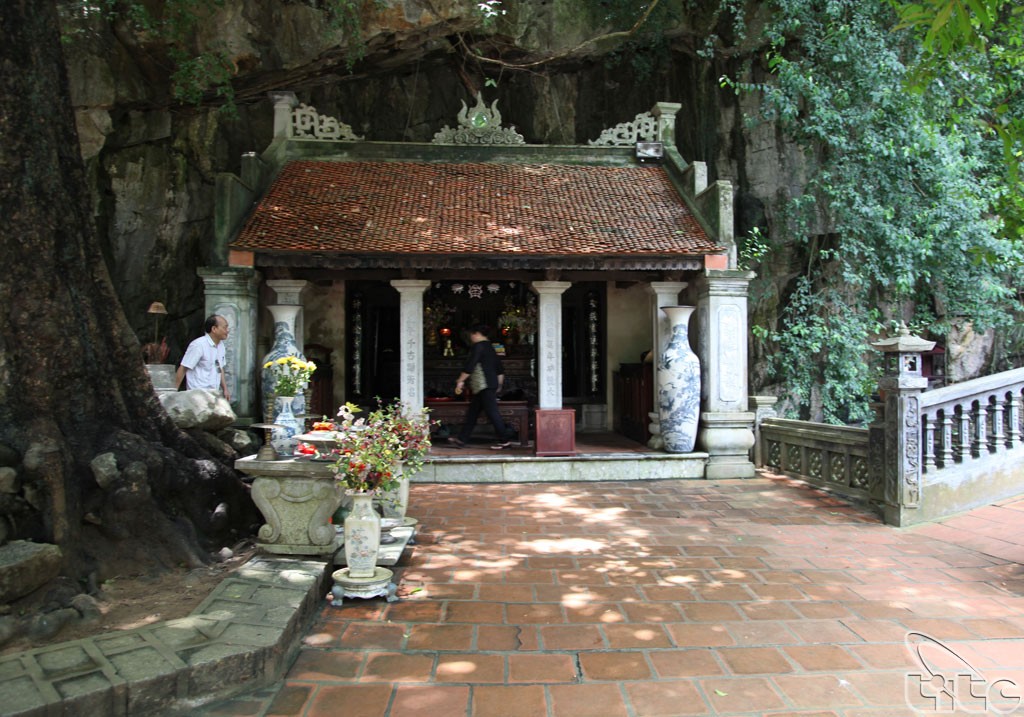
traditional way of life. Several historic temples and pagodas, some perched
high on the valley walls and peaks, signify the important spiritual and
religious associations with the landscape. The countryside of the surrounding
buffer zone presents a picture of traditional rural life with gardens and
fields among small villages linked by simple tracks, narrow roads and a network
of streams and canals.
Geological and geomorphological
value
Trang An displays the end stages of karst tower
landscape evolution in a humid tropical environment. The product of deep
dissection of an uplifted limestone massif over a period of millions years is a
remarkable array of classical karst landforms, including cones and towers,
depressions (cockpits), valleys (poljes), rockfall collapse structures and
deposits, subterranean caverns and rivers, caves and speleothems. A network of
cross-cutting parallel faults divides the area into cells and promotes the
development of enclosed depressions. An altitudinal series of erosional notches
in rock walls with associated caves, wave-cut platforms, beach deposits and
marine shells is evidence of former stands of sea level.
On 23 June 2014, in Doha (Qatar), World Heritage
Committee of United Nations Educational, Scientific and Cultural Organization
(UNESCO) recognized officially Trang An Landscape Complex as World Cultural and
Natural Heritage Site based on three criteria: culture, aestheticism and
geology � geomorphology.
Main tourist sites
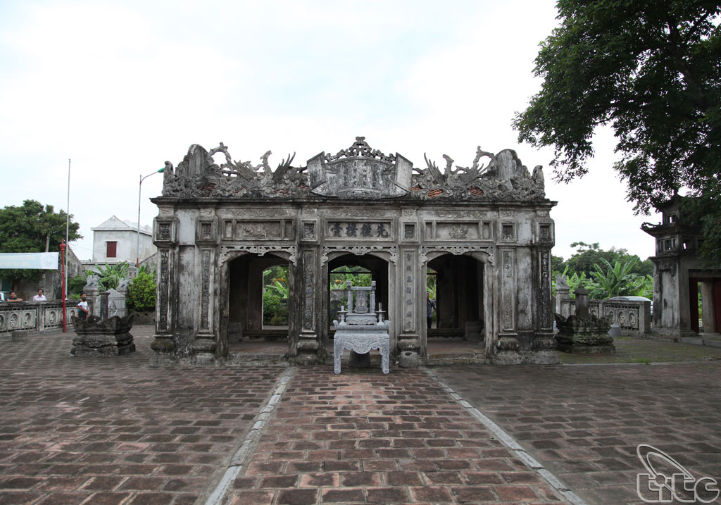
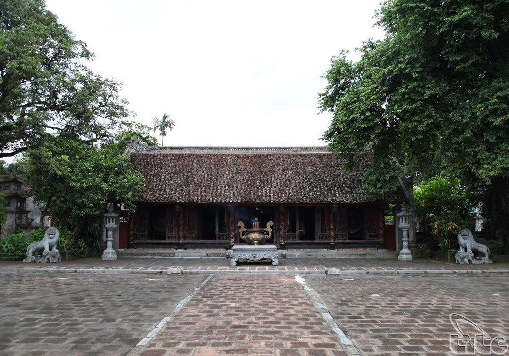
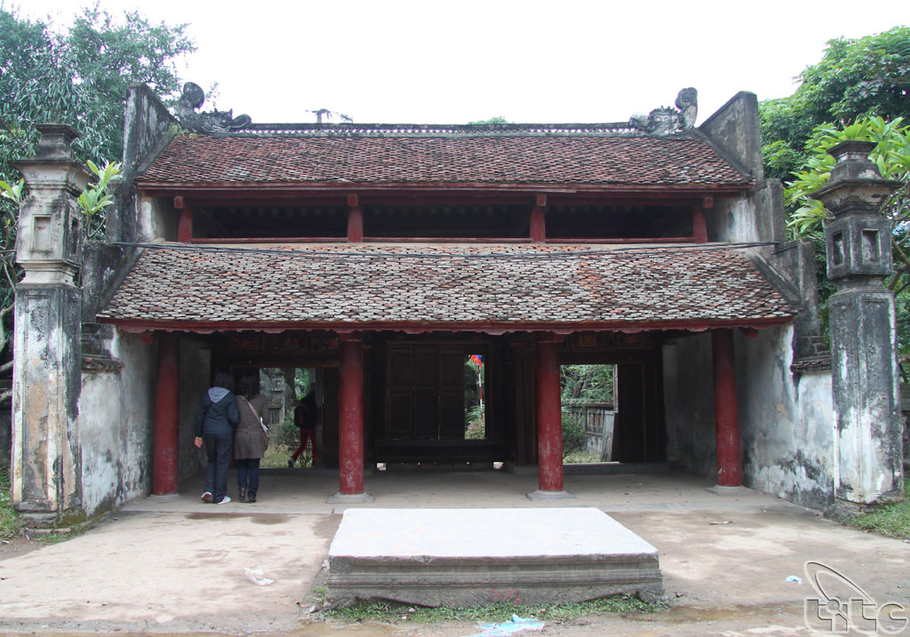
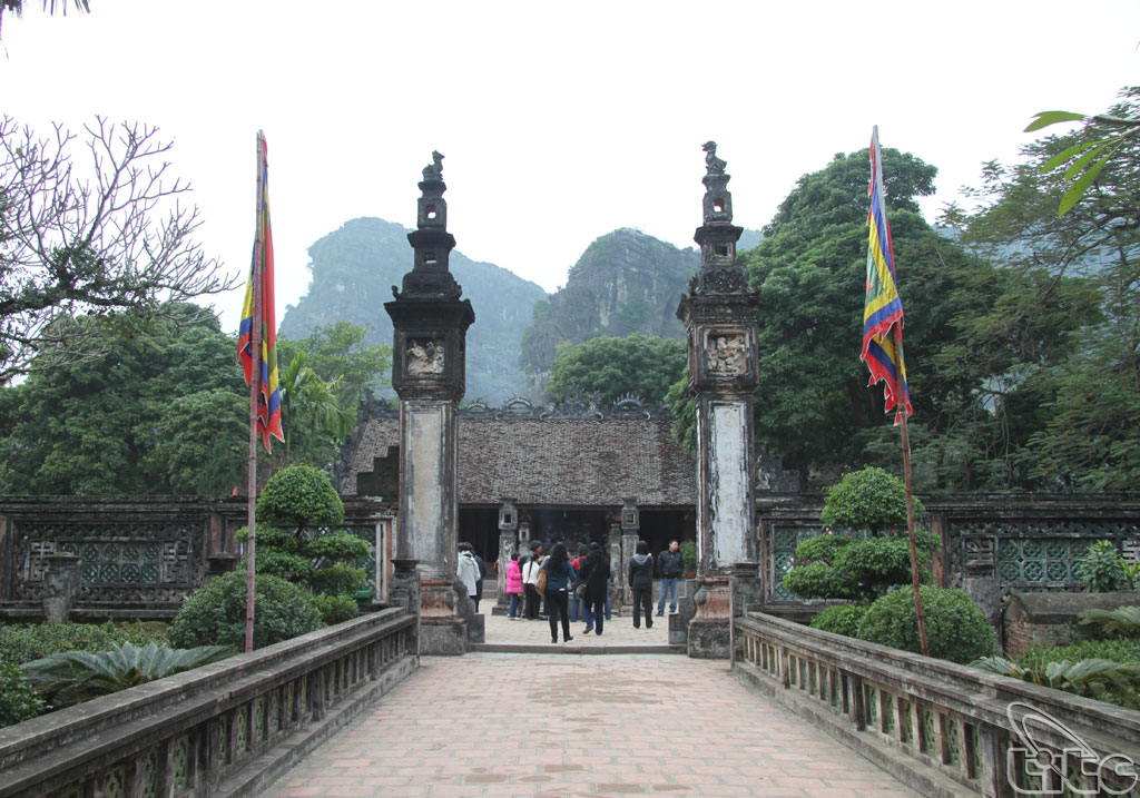
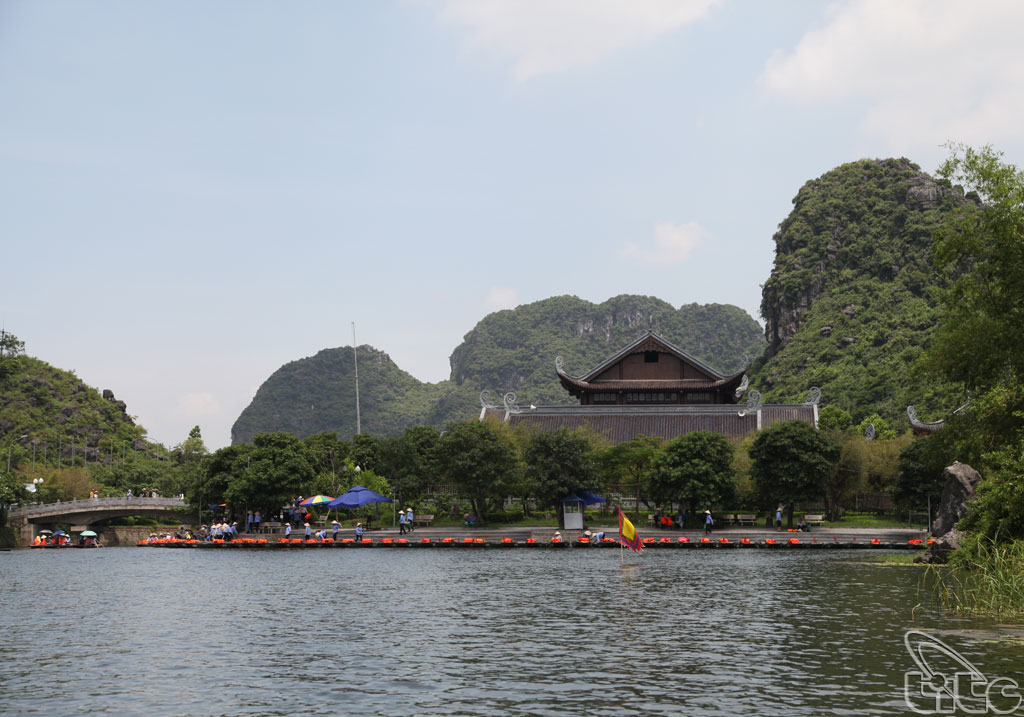
Hoa Lu Ancient Citadel Cultural � Historical
Area: King Dinh Temple, King Le
Temple, Co Am Pagoda, Kim Ngan Pagoda, Duyen Ninh Pagoda, Nhat Tru Pagoda,
Thien Ton Grotto�
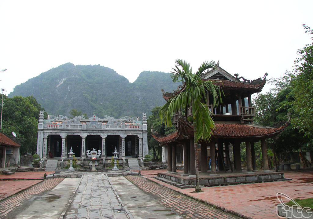
Trang An Scenic Area: Trinh Temple, Tran Temple, Tu
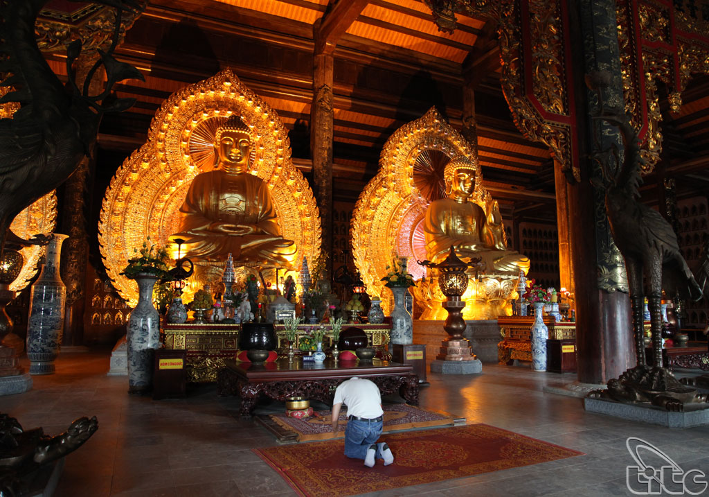
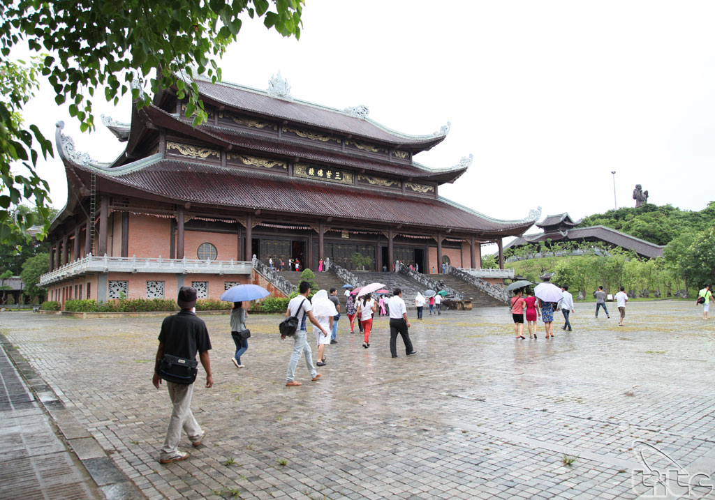
Tru Temple, Dia Linh Cave, Sinh Duoc Cave, May Cave, Nau Ruou Cave, Bai Dinh
Pagoda Complex�
Tam Coc � Bich Dong Scenic Area: Bich Dong Pagoda, Linh Coc Pagoda, Thai
Vi Temple, Thien Huong Grotto, Tien Grotto, Thien Ha Grotto, But Cave, Mua
Cave, Ca Cave, Thung Nham, Thung Nang, Co Vien Lau Ancient Village�
Thu Giang